How prepared for climate change are we as a community? As individuals? Do we have the knowledge and resources to respond to and recover from the results of climate change such as extreme weather events? It is important that we work together as well as independently to ensure that we are self-sufficient in the case of an environmentally-based emergency.

Resilience
What are the current climate risks?
As climate change has progressed, we have seen more and more ways that we can be affected by it. Shifting weather patterns and more frequent extreme weather events are already taking their toll locally and worldwide, and this in turn affects our food supplies, housing security, and economies. These risks are present globally but have been recognised to disproportionally impact poorer communities as they have less resources for resilience. We hope that by sharing information and resources we can help all of Wellington be prepared for climate change and recover from events quickly.
Flooding
Wellington has experienced several instances of flooding over the past decade, with the severity of these events increasing as time goes on. Part of this is due to the increased housebuilding in the town causing more runoff as there are increased impermeable surfaces. In tandem with this we have seen more extreme weather in recent years with the September 2023 storm seeing the most rainfall in the town since 1969.
Local meteorologist Simon Ratsey has been keeping weather records since 1962 and on Sunday 17th September 2023 he recorded 102mm of rain over a period of less than 36 hours, with 40mm of this rain falling within just a 2 hour span. The 1969 rainfall totalled 116mm though it was a more sustained fall and did not match the intensity of the 2023 storm. In the past 60 years there have been just 8 instances where the daily rainfall in Wellington totalled over 70mm, showing that this one day was very unique. To learn more about Wellington’s weather patterns over the past 50+ years, pick up Simon Ratsey’s pamphlet “Wellington’s Weather” at Wellington Museum.
Wellington as a whole is not as susceptible to flooding as some other towns though there are a few areas within our boundaries that are at a significantly higher risk than others. The map to the right shows the areas of town that are at risk of flooding both from natural waterways (RoFRS – Risk of Flooding from Rivers and Sea) and surface water (RoFSW – Risk of Flooding from Surface Water). This has been created by the Environment Agency from their data and shows the areas of risk with darker colours denoting a greater risk.
You can also check your current and long-term risk via gov.uk as they have used data to predict how flood risk will change in the coming years with climate change.
Temperature
As global weather patterns shift as a result of man-made climate change, we are seeing extreme temperatures more and more frequently. In 2022 we saw heatwaves all over the UK with a temperature of 40.3°C recorded at Coningsby, Lincolnshire on 19th July – the highest temperature ever recorded in this country. Wellington also saw its highest ever temperature at this time, reaching over 34℃ degrees.
High temperatures are becoming more and more common in the UK, with Wellington’s mean annual temperature 1.1°C higher between 2001 and 2025 than it was between 1971 and 2000. In addition to this, Wellington has seen a trend of reduced air frosts in the winter. This may seem like a positive change for us as it means less time shivering, but it can in fact be very disruptive to ecosystems that rely on frost and cold periods.
In the UK houses are built to keep the heat in which is perfect for our cool and damp climate. However, as summer temperatures now regularly exceed heatwave thresholds (26℃ in our area) our homes are becoming uncomfortable and even dangerous. Features that are great in the winter, such as lower ceilings and suntraps, can work against us in the summer. If we are unable to cool down due to our homes being too hot our health will suffer and more people will die annually due to heat related causes.
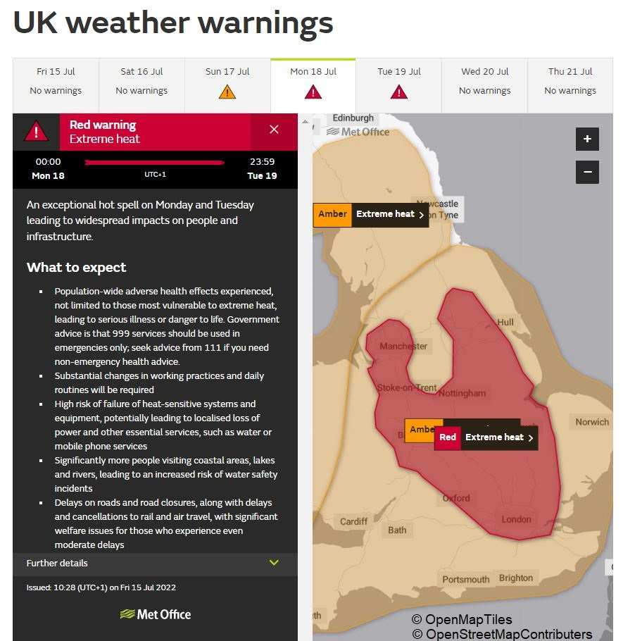
In the summer of 2022 there were several periods of high heat including some prolonged episodes. The Met Office issued its first ever red warning for extreme heat in July 2022, just one year after its Extreme Heat National Weather Warning Service was introduced. During the summer of 2022, there were 2,985 all-cause excess deaths observed in line with five heat episodes. The group most at risk of this is by far the elderly population, with people aged 85 and older accounting for 56% of deaths in the 2022 heatwaves. Extreme heat can be dangerous in a number of ways, leading to exhaustion, dehydration, and heat stroke. Heat can also exacerbate existing health issues, making people with conditions such as asthma, diabetes, heart conditions, or blood clotting disorders more at risk. In hotter weather there is also an increase of illnesses an fatalities associated with open water swimming with people contracting leptospirosis (Weil’s disease), Norovirus, or E Coli.
Extreme temperatures affect more than just our health. As mentioned above, our infrastructure has been designed and built to withstand our damp and temperate climate. The temperatures we saw in 2022 caused widespread disruption throughout the country with trains buckling, overhead cables sagging, and planes suspended as heat affected runways. Wildfires broke out in a number of places across the country and there were power cuts in areas of Yorkshire, Lincolnshire, and the North East.

Food and Water Availability
Changing weather patterns have knock-on effects on the availability of food and water worldwide. Developing countries are particularly at risk due to their already fragile food and water supplies and those experiencing war or political instability have even more pressure on their resources. As well as this, countries with already more extreme climates such as those in Sub-Saharan Africa and South Asia are vulnerable due to the increased likelihood of droughts, storms, and floods.
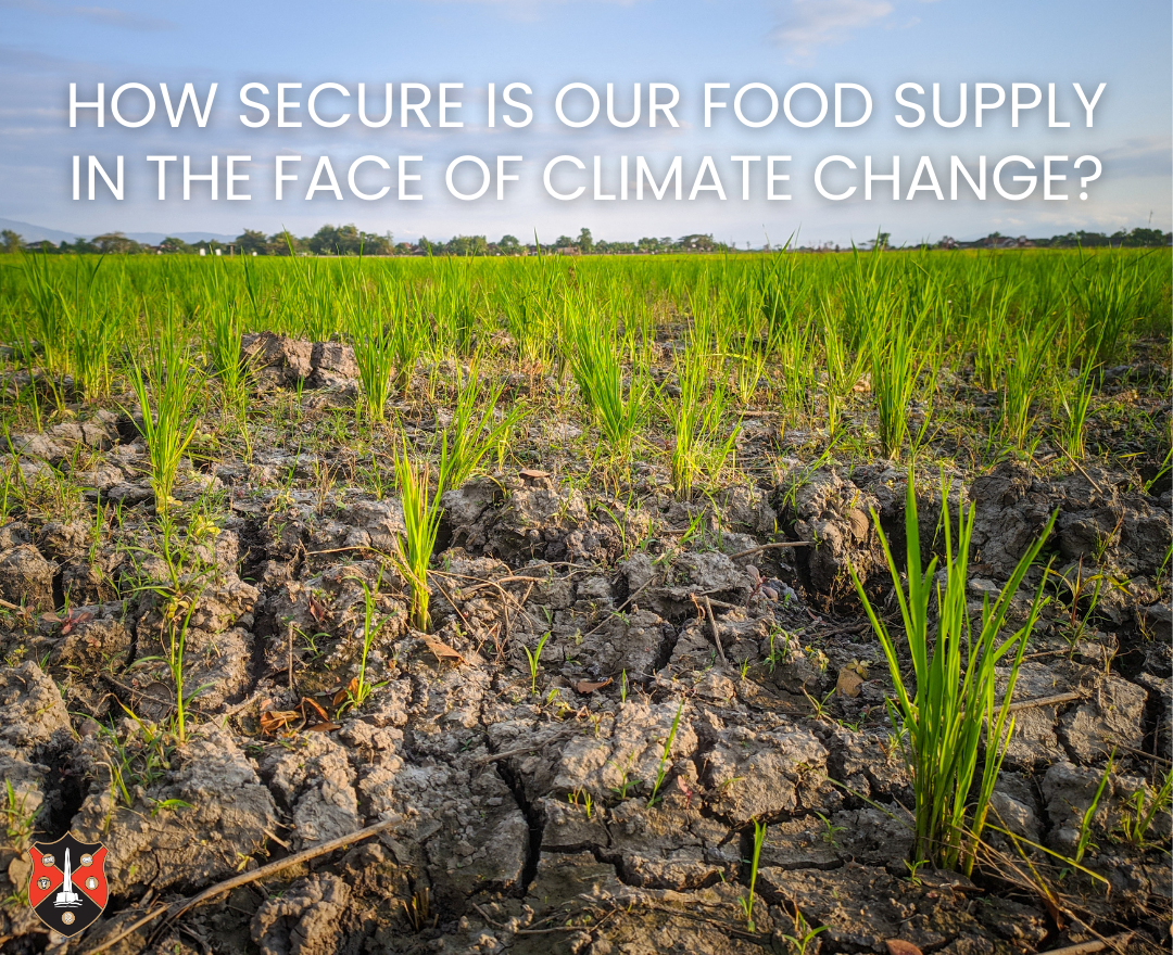
The UK’s food and water security is also at risk, with summer 2025 showing us how a prolonged drought can deplete reservoirs and affect crop yields. In addition to this, extreme rain like that seen in September 2023 will flood farmland. This flooding does more than just destroy the current harvest; it can erode soil nutrients as water moves across the surface, reducing the quality and yield of future crops planted in that field.
The UK also has a reliance on food produced in other nations to keep our shelves stocked year round. In December you may enjoy grapes from Morocco, tomatoes, from Spain, or apples from South Africa. Each one of these regions faces a more immediate risk of climate change related weather extremes and such events can disrupt the food supply chain, raising prices or making some items outright unavailable.

What can we do to prepare?
We all have a responsibility to do what we can to be prepared for the future. The world is changing fast but our communities can come together to offer support in times of need.
Defend Against Flooding
If you live in an area prone to flooding, either from watercourses or surface water, it is best practice to have a plan on how to protect your home and a strategy to evacuate if necessary. A great place to start would be to sign up to the Government’s flood warning service where you can get automatic messages about flooding by text, phone, or email.
Plan Ahead
If your home is in a flood risk zone, we highly recommend creating a personal flood plan. This will allow you to have a useful checklist to use before a flood occurs and gives you advice on how to protect important documents as well as gives you a central place to store important contact details in case of an emergency. Templates produced by the Environment Agency can be found on the UK Government website. Plans are also available for community groups and businesses.
Protect Your Property
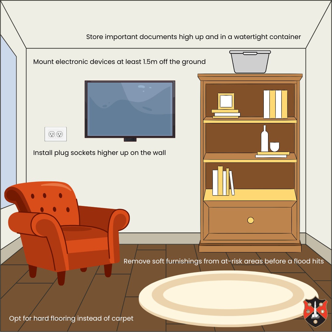
There are many options for how you can protect your home against floodwater or minimise the damage it can do. Strategies range from flood protection products to more involved structural adaptations. It is up to yourself as the homeowner to evaluate the cost vs benefit of these mitigating measures and decide what works best for you in your home.
A few examples of how you can protect your home are as follows:
- Use sandbags to block floodwater from your door
- Apply dampproof coatings to at-risk walls
- Use self-closing air bricks or buy a cover
- Fit flood resistant valves to drains and pipes
- Install plug sockets higher up on the wall
For more information on how you can protect your home from flooding and how you can deal with the aftermath, please click here for more information from the UK Government.
Get Insured
If you are a homeowner you should make sure that your property is insured against flooding. If you are in an at-risk area you may be required to flood-proof your home to a high standard to avoid high premiums or excess costs. If your home has a history of flooding you must inform your insurer of this. Flood insurance covers the cost of removing debris, repair and replacement of damaged furniture, and can also cover the cost of alternative accommodation if your home becomes temporarily unliveable due to flooding. You can get advice on insuring your home against flooding via the National Flood Forum.
If you are renting and live in a property at risk of flooding you should ask your landlord what insurance they have as it may not cover your personal items. If their insurance does not cover your possessions, you can get contents insurance that will pay to repair or replace lost goods.
Keep Your Home Temperate
Too hot, too cold, or just right? Keeping our homes at a comfortable temperate can be difficult, especially if they were built long ago. We have collated a few tips below for how to keep your home warmer in the winter and cooler in the summer. Make sure you also check out our energy page for more detail on some of these!
Insulate
Properly insulating your home is the first step towards keeping temperatures consistent and reducing your energy bills. Depending on how your house is built, you may have different options on how you can insulate. Roof insulation is the most common and one of the most effective. Houses built after the 1920s will often have a cavity wall, this prevents damp and can be filled with various materials to reduce heat loss or keep heat out.
If you have an older house (pre 1960) you most likely have a suspended timber floor with a cavity underneath. These features are great for ventilation and prevention of damp but can be heat sinks when the temperature drops. Make sure your home is protected from this chill underfoot with rugs or carpet.
Doors and windows need attention too as these are weak points that heat can transfer through. Doors and windows with good seals, double glazing or multiple layers are considered to be the best as they reduce drafts and heat loss in winter and keep heat out in the summer.
UV and Infrared Protection
Windows are important for letting light into our homes and allowing us to circulate fresh air. In the height of the summer however, they can be a source of unwanted heat as glass allows sun rays to come inside. You may be familiar with how UV rays can be damaging to our skin, but the energy that they carry converts into heat when it is absorbed by solid matter. Though UV rays are not the primary source of heat from the sun (that’s Infrared) both can work to heat up our buildings just when we don’t want them to.
Keeping blinds and curtains closed is a cheap and easy way to reduce this heat exchange, but it does leave you in the dark. If you want the best of both worlds – light flooding into the room but no harmful or heat-carrying rays – your best bet will be a specialised film coating for your windows. These are available online and can be fitted DIY style or there are a number of companies that will offer a fitting service. An added bonus to these films is that they prevent furniture and carpets from fading in the sun and a number of options also offer privacy as they are only transparent one-way. Another option is to have retractable awnings over windows – these can be deployed in the summer to shade your windows and stop that heat coming in.
Fans, fans, fans!
We all have a desk or standing fan at home for when the weather gets too hot, but have you considered investing in a ceiling fan? Popular in regions with hot climates and throughout the United States, ceiling fans push air downwards to help your body evaporate perspiration and create a breeze that passes over your skin, cooling you down. This effect is described as “wind chill” and allows a room to feel cooler without actually having a lower temperature.
Ceiling fans are far more cost effective and energy efficient than air conditioners as they use about 1% of the electricity required to run an air conditioner. As an added bonus, many fans can be set to rotate clockwise for the winter time, where they will work to circulate ay warm air trapped near the ceiling. It is best to install ceiling fans in rooms that are occupied a lot such as the living room or bedrooms as they work to cool the individual, not the room itself.
Be Mindful of your Food & Water Supplies
Resilience is all about your ability to live through and bounce back from difficult times. If we plan ahead when it comes to our food and water supplies, we are better able to be resilient in the face of climate change.
Local Sources
When we source our food from local suppliers and farms, we are directly supporting our local community. This in turn leads to community resilience where we are all able to work together to weather challenges. If local farms and businesses are supported then they are able to invest back into their own infrastructure and make themselves more adaptable. Farms can improve irrigation systems and soil quality and businesses may be able to increase staffing or opening hours.
Keeping Cupboards Stocked
Fresh food is almost always best but there is a lot to be said for the benefits of tinned goods. They are cheap, convenient, and have long shelf lives. They are valuable for everyday cooking and are especially great to have on hand in case of food shortages or high grocery prices. It is recommended that you keep a few essentials in your cupboard to help supplement meals or to keep for times of need. Some good tinned items to keep are:
- Mushrooms
- Potatoes
- Baked beans
- Soups
- Sweetcorn
- Lentils
- Kidney Beans
- Tuna
- Chickpeas
- Tomatoes
Make sure that you keep track of the use-by dates of items and use the oldest items first. Although tinned goods can last for years, you should follow the manufacturers instructions for the use-by date and not use any tins that have a broken seal, are leaking, dented, or have bulging.
Water Storage
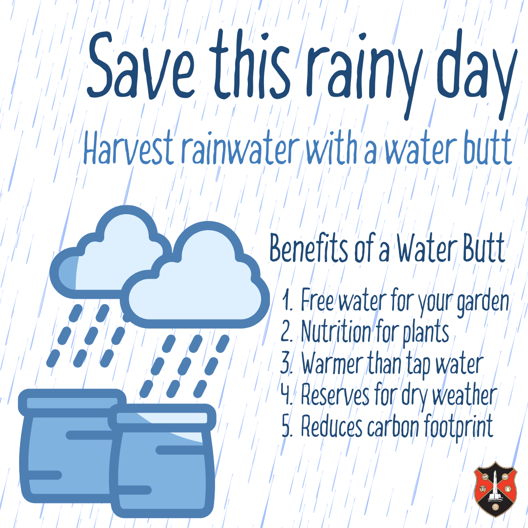
Wellington is in a fortunate position to have good quality tap water from the nearby reservoirs at Wimbleball and Clatworthy. These bodies of water maintain good reserves even in times where the rest of the country suffers from drought. It is however sometimes the case that we face low enough reservoir levels that we are urged to conserve water and can even face hosepipe bans. If you have a garden we recommend that you have a water butt for times like this to ensure that you can keep everything hydrated and healthy. This is also helpful when we are not in times of drought as harvesting rainwater is a free and easy way to look after your garden.
In areas with poorer water quality households may consider buying bottled water for drinking or using a filter for their tap water. At this time this is not a necessary precaution in our area but some people choose to use filters to improve their water further. It is very rare that we experience losses to our water service and when we do we usually have plenty of advanced notice as it is due to maintenance works. When this happens, residents should stock up on bottled drinking water to see them through a gap in the supply.


